by Janet Irving, PaBIA Education Committee
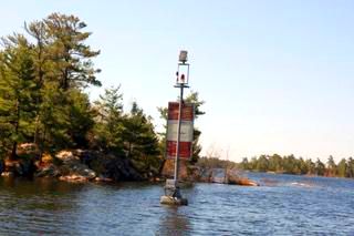
In the summer of 2013, just seven years ago, we were alarmed by extreme low water levels in Pointe au Baril—forcing us to build new dock ramps, avoid shoals we never noticed before, and take long detours to our cottages when inlets became too shallow to navigate. Now our water is so high that our dock ramps tilt upwards from shore, shoal markers are submerged, and many of our generations-old boat houses are six inches under water. Quite a difference in only seven years.
This year, Georgian Bay has broken the record for the highest water levels in history. In Pointe au Baril, during a strong west-wind storm, water lapped over the government docks, and (even on a calm day) many of our “lollipops” seem to be floating on the water. My island has been split in two, with no footpath to our back dock, where a cabin my father built in 1938 is submerged by the encroaching shoreline. But even if our buildings and docks aren’t adversely affected, the shore is in a place we’ve never seen it before, and we see a startling negative effect on the well-being of our fauna and wildlife in our waters and on our shores. What will become of them in their greatly changed environments?
I wanted to know why we experienced a record low, followed by a record high in such a short period of time. So this spring I did a little research and attended several webinars to learn what is up—and down—with our water.
David Sweetnam of Georgian Bay Forever (GBF) presented one of the most concise webinars on why we have seen this rapid and extreme transition, and what we might expect in the future. What he emphasized, is that extreme transitions in water levels are the “new normal,” and conditions that we have seen in the past against which we normally compare the present are not reliable guides for us now, or into the future. Too many new factors that affect water levels have converged; extremes are and will continue to be normal.
The overriding “culprit” in rapidly changing water levels in Georgian Bay is a changed climate, caused by greenhouse gas emissions that are warming the entire planet—this will surprise no one but the science-deniers. While there are many other factors, such as post-glacial tilt, tides, and man-made diversions and control structures, warmer global temperatures account for most of the net basin supply changes (the change in the amount of water going into the Great Lakes vs. the amount going out). And, according to Sweetnam, the biggest factor in this climate change affecting water levels is the escalating amount of energy in the atmosphere, which produces more precipitation in more severe weather patterns.
The last five years have been the hottest on record, and this year will continue that trend. All over the world, extreme rainfall events and severe flooding are happening four times more frequently than in 1980. In Georgian Bay, average temperatures have increased -16º C (2º F) since the 1950s, and frost-free days have increased by 16 days. Total precipitation has increased by 14% and heavy precipitation events are up by 35%. We have received more precipitation in the past three years than at any time in recorded history. And although our number of extremely hot days—over 90 degrees—have not increased significantly in the Bay, the increase south of us, in Illinois, is alarming, and we lie directly in the path of storms created there. It’s difficult to imagine, but there is the possibility of hurricane-force winds and tornadoes moving into the Bay—causing even higher water levels in our future.
There are other ways these storms create high water levels. For example, they cause increased saturation of the ground, so that the water isn’t absorbed on land but flows back into the lakes. And stronger and faster winds (which have increased 5% per decade since the 1980’s) from these high-energy storms create increased wave activity and coastal erosion (at both high and low water levels). Warmer air also affects the snowfall, cloud cover, and ice formation on the lakes. For example, the less ice coverage there is in winter, the earlier spring arrives and the more evaporation occurs—putting more water into the atmosphere to fuel those heavy rainfalls.
The interplay between precipitation and evaporation is critical in understanding water levels, but so are the man-made diversions of water, and controls on the connecting channels between the lakes. These are monitored by the International Joint Commission (IJC) whose mandate is to make sure water levels support and sustain many activities on all the lakes, such as power generation, commercial fishing, shipping, tourism, and environmental health. Georgian Bay is only affected by those in the upper lakes—Superior, Huron, and Michigan.
There are two diversions above Lake Superior, at Ogoki and Long Lac, which were built roughly eighty years ago to redirect water that naturally flows north, southward into the lake for power generation and the logging industry. Near Milwaukee there is a diversion at Ankesha that takes water out of Lake Michigan, although it is regulated to return the water in equal amounts, so it is not a significant influencer on water levels. Exceptions to the regulations are permitted—but it is a controversial matter, beyond the scope of this article.
There are connecting channels with water-level controlling structures at St. Mary’s River between Superior and Huron, and without controls at the St. Clair River between Huron and Erie, as well as on the Niagara River between Erie and Ontario—all of them monitored by the IJC. Together, these diversions and structures comprise a complex system, designed to regulate the best outcomes for all the lakes’ industries and environmental concerns, but most of these constructs were built over a hundred years ago for changes in water levels that happen over hundreds of years, not seven. The challenge facing the IJC is daunting.
As Sweetnam says, “It is the balance between precipitation and evaporation and other parameters such as runoff, and outflow at connecting points, that dictates what happens with water levels.” No one can offer easy or perfect solutions to this complex issue of a “new normal” with extreme water level transitions. The future is uncertain. As we witness our changing shorelines, and experience weather that is often damaging and certainly frightening, we should support the groups that are working hard to keep Georgian Bay and its wildlife, plant life, and human life healthy and safe, and sustainable for future generations.